Geometries representing project infrastructures or any other project-related points, lines and polygons can be imported and displayed on the map. Project infrastructures are visible under Infrastructures layer of the map.
Import Geometries
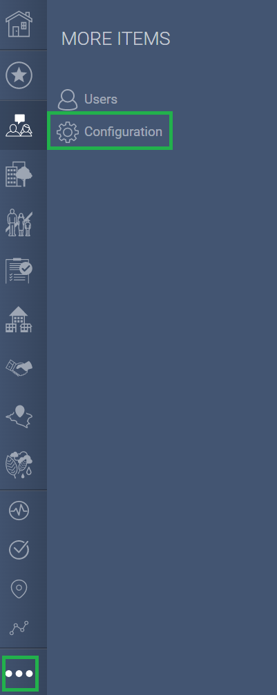
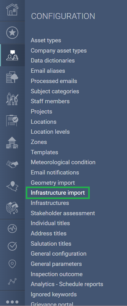
1. In the main menu go to "Settings" and "Configuration" and select "Infrastructure Import". Click on the "Create" button, if have not created an import list already :


Geometries to import must be in ESRI Shapefile format (.shp) compressed as a ZIP archive. Typically the .zip file will contain four files : the .shp shapefile and its related .shx, .dbf and .prj files.
Shapefile database values of columns labeled ID, NAME and DESC, if any, will be loaded in the system along with the shapefile for identification on map and in corresponding record. (Please refer to the Templates linked at the bottom of this article for each type of infrastructures)
Upload Geometries (If infrastructure already created)
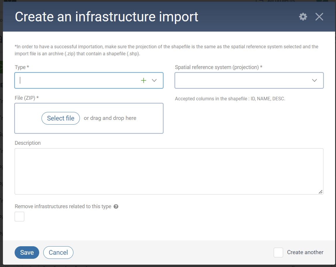
- Click Upload and select ZIP file to load.
- Select infrastructure Type (which will correspond to a sub-layer of the Infrastruture layer). Available infrastructure types are defined under the Infrastructure Type dictionary table (Application Settings > Configuration > Data dictionaries).
- Select Spatial reference system. The value selected must match the shapefile's projection.
- Check Remove infrastructures related to this type if you want the content of the map layer for the corresponding Type to be replaced. Leave unchecked to append to existing content.
- Click Save and View.
- Wait a few seconds for the system to process the uploaded file then refresh the page (F5) to see import results under Import Result section of the General Information tab. Any errors are listed under Import errors table.
- Imported map objects are listed under Infrastructures tab.
Any import can be reverted (imported objects removed) through Actions > Revert import.
View Infrastructures on Map
Infrastructures are available to view using the map under Infrastructure. Each infrastructure type has its own sub-layer.
To locate specific infrastructures on the map, search for its corresponding record in Application Settings > Configuration > Infrastructures and either click on the map icon or open the infrastructure's record.